Buføre-/Pilegrimsvegen
Information on the historic hiking route Buførevegen
NB If you like to hike here, a local guide is recommended, especially if you want to hike the entire route between Reisæter and Botsvatn.
From Reisæter hiking Buførevegen
Taking cattle from Reiseterlia across the high mountain down to the rich grazing land in upper Krossdalen, Jondal, has probably been going on from the late 1200s till 1941.
The restoration of Buførevegen has been going on since 2012; among other things by paving the path and raising cairns.
Start/parking:
From road 550, take road 109 from the crossing at Nå Auto and drive 3,7 km up to Reiseter, at 330 m above sea level. There is a parking lot (but make sure that your parking does not affect the farm work).
Description of the hike:
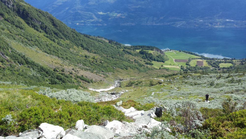
From the parking lot; follow the farm road towards the southwest to Skrelet. A woodland road just south of Bleieelva will lead you to the paved track upwards Reiseterlia, past Drivdal, Øykjavadet, Nedste Kvilingehaug, Øvste Kvilingehaug to Reisetereggjet, at 1200 meters above sea level, where the first direction cairn is erected. Upwards Reiseterlia, walking on a beautifully paved track, you will have a wonderful view overlooking Reiseter and Sørfjorden; “a stairway to heaven”. This is at least a two hours’ walk. Buførevegen and the Pilgrimage track merge in Reiseterlia, within the borders of Folgefonna Nasjonalpark.
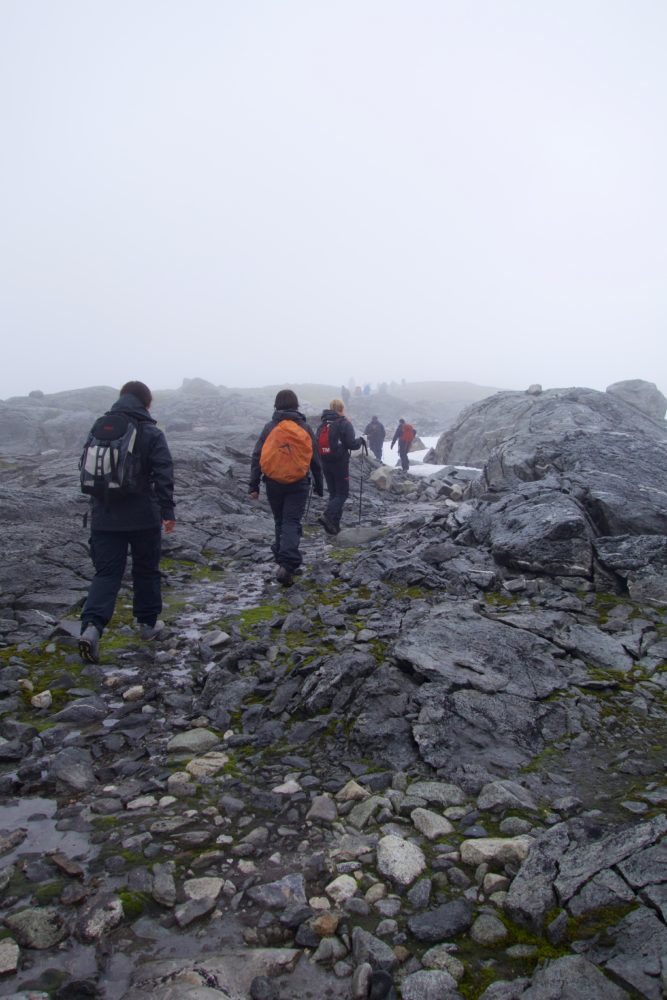
From Reisetereggjet the track leads you to the crossroads where the Pilgrimage track continues towards the west, while Buførevegen heads a bit to the north. Thereafter the track once again follows a more westerly direction from the cairn on the height. In nice weather you are advised to follow the cairns! Make sure that the cairns always are on your left hand all the way until you reach the height above Botsvatn. It is of great importance to follow the cairns!
Further on to the highest point, the cairn at Klokkarane, 1422 meters above sea level, the hike follows a varying up-and-down terrain. Then the terrain slightly falls towards Forvana. The track crosses a brook and passes a rock. If the winters have been cold with a lot of snow, the hike in some parts follow snowdrifts. The track then is partly bendy towards Kjelavarden, and further on it follows a slightly falling terrain towards Brattefonn. It can be a bit difficult to walk here when the snowdrifts are steep. The track passes Øvste Skarvabotnen, upwards Jehovakleivene and further through easy terrain via Primkleivane until you reach Jonsteinkleivane. There you will find a steep, but short, ascent. Sofaen behind Jonstein looks like a ”bench of velour”, covered with moss where an overhanging rock makes you sit quite dry.
From Sofaen the track leads you downwards to Tobaksdalen where it turns left by the cairn. Here you will walk in a terrain of heather and moss down to Botsvatn, a mountain dairy farm, and then along the southeast side of the lake towards the road barrier and the parking lot. From here you can drive down to Jondal.
Season:
July – October.
Do not try this hike during winter. There is a great danger of an avalanche in the mountainsides during winter. The hike in Reiseterlia crosses the avalanche path, and avalanches come almost every winter.
Advice for the hike:
As quite large parts of the hike pass across snowdrifts you are advised to wear mountain boots. Be aware of rapid changes in weather, from sunshine when you start into wind and rain/snow in the high mountain.
Be sure to bring suitable outfit for rain, wind and cold. Remember cap and mittens. Wool is highly recommended.
It is also important to bring a packet of sandwiches to last for a long hike. The water in brooks can be enjoyed as drinking water, but at your own responsibility.
It is wise to bring a rope (cf. Brattefonn). Also bring a map and a compass, possibly a GPS. At the mountain plateau there is lack of, if any, mobile signals.
You have a free access to outlying fields, but please take care of and respect nature and wildlife. Please do not leave any litter.
If possible, take your first hike in company with locals.
The hike is quite demanding, so it is advisable to be fit and have some experience from mountain hikes.