
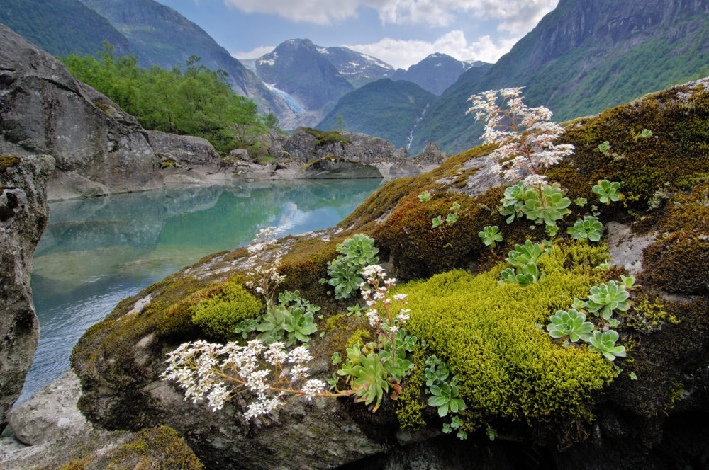
Bondhusdalen valley
Those who have been here, consider Bondhusdalen to be the most beautiful of the many valleys below the Folgefonna glacier. The highlight is the stunning icefall at the head of the valley, reflected in the lake of glacial meltwater.
The magnificent icefall and valley have drawn tourists since the mid 1800s. As you walk from the quay in Sundal, a hamlet on the shore of the Maurangerfjord, you are retracing a historic path. The Ice Road wasn’t built for tourists, but rather to transport ice, which was used for refrigeration in the towns and villages up and down the coast.
It’s an easy hike; the gravel road up to Bondhusvatnet lake is also suitable for strollers and wheelchairs. A round trip takes about two hours. The trail to the far end of the lake – and better view of the icefall – requires sturdy footwear. The trail continues up to a moraine below Bondhusbrea. Allow three hours for the hike to the far end of the lake and back again, and four hours if you’re hiking to the moraine.
When Queen Sonja of Norway officially opened Folgefonna National Park in 2005, the location chosen for the ceremony was Bondhusdalen. Her Majesty’s signature is on a rock by the lake.
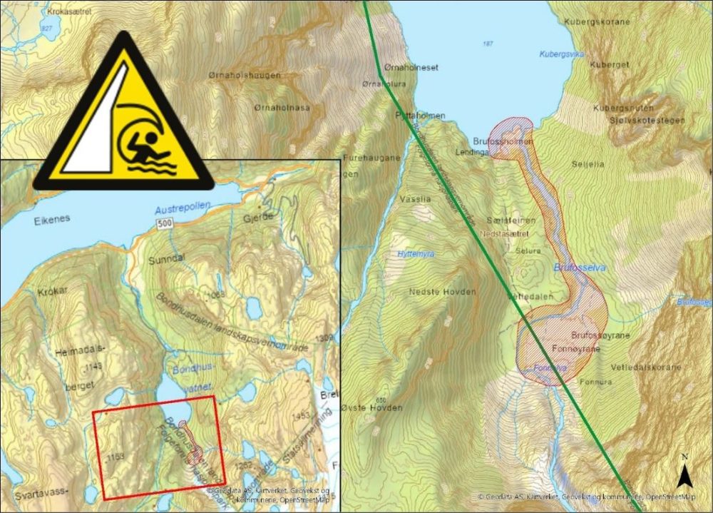
Safety and natural hazards
Glaciers are in motion and large blocks of ice can break off from them without warning. Always keep a good distance from the glacier front! Now that the climate is warming, the glacier is retreating rapidly. In the last 10 years alone, Bondhusbreen has melted back as much as 320 meter. This causes changes in drainage patterns and waterways.
Warning: glacial dammed lake and potential flooding hazard at the far end of Bondhusvatnet lake!
In May 2026, a glacial dammed lake formed on the edge of Bondhus glacier at an altitude of approximately 1350 meters. There is a risk of sudden drainage of the glacial lake, a so-called glacial lake outburst flood (GLOF). This can create dangerous situations along the river that comes down from Bondhus glacier, and on the delta/stone beach at the far end of Bondhusvatnet. A rise in water level and changes in the river course can occur suddenly and without warning.
For safety reasons, we ask all visitors to:
- Stay clear of the shaded area on the map
- Avoid camping close to the water
- Respect signs and barriers
It is still regarded save to hike the main gravel road from the parking to Bondhusvatnet lake and visit the picnic area.
Activities
Hiking in norwegian nature
The Norwegian outdoors is fantastic, but hiking or skiing in it can be challenging. Both terrain and weather vary, so it’s best to be well prepared. Load your pack well; know how to use and always carry a map and compass. Here are some hints for safe hiking and skiing in Norway. Enjoy your trekking!
CABIN VISIT FROM A TO Z
Most DNT cabins are self-service (with stocks of provisions) or no-service (no provisions stocked). Here’s a guide to staying at a cabin