
The Geological Trail in Nordrepollen
For an extended exploration of the fascinating interplay between ice and stone, consider hiking the Geological Trail. This path, from Nordrepollen to the glacier arm called Botnabreen, will give you a greater understanding of how the landscapes of Folgefonna National Park were formed.
For an extended exploration of the fascinating interplay between ice and stone, consider hiking the Geological Trail. This path, from Nordrepollen, in the innermost reaches of the Maurangsfjord to the glacier arm called Botnabreen, will give you a greater understanding of how the landscapes of Folgefonna National Park were formed.
The varied landscape tells a fascinating story – if you know how to read it. Fortunately, the information boards along the Geological Trail were written by some of Norway’s foremost geologists and botanists. Let the landscape be your teacher!
Powerful natural forces have formed the dramatic scenery you encounter: heat, tectonic movement, pressure, ice and water. Here, beautiful plants are well adapted to the rough climate and sparse soil, where snow covers the land much of the year and the growth season is short and intense. A good example is pyramidal saxifrage, one of Norway’s two national flowers. (The other is common heather.)
Pioneer plants
The first stage of your hike, from the hamlet Øyre on Nordrepollen, takes you up through the alder forest in the valley of Øyresdalen. Alder is a hardy tree that can endure low temperatures and nutrient-poor soil; the tree lives in symbiosis with a bacteria that allows it to absorb nitrogen directly from the air. Other hardy trees that grow near the glacier are birch and dwarf willow. In Fagerdalen there is also rowan, whose berries are spread by birds. Over time, rotting leaves from “pioneer plants” gradually build up soil, so that other more demanding plants may grow.
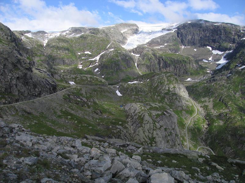
Carving valleys and fjords
Botnane has a particularly fascinating geology. Here are different types of bedrock minerals. For instance, the blue stones you see are serpentinite. The bow-shaped moraines of gravel and sand in the middle of the valley were deposited by retreating ice. Another telltale sign is the horizontal gouge marks you can see on the mountainsides. The icecap used rocks, gravel and sand as abrasives to scour and grind away the bedrock – over time carving out the valleys and fjords. A glacier river delta.
Summer pastures
Local farmers used to bring their livestock to summer pastures in Godalen and other valleys below the Folgefonna glacier.
The Little Ice Age
Glaciers advance and retreat according to the climate. During a chilly period known as the “Little Ice Age” a couple of hundred years ago, Folgefonna filled entire valleys with ice.
As you walk this pristine landscape, you might be surprised to hear that electricity is being produced from the meltwater. In fact, the pioneering Folgefonna hydropower project has the first network of tunnels built beneath the glacier.
An illustrated brochure on the Geological Trail (Geostien) is available from the Folgefonna gateways and local Tourist Information Offices. The brochure has a wealth of detailed information, including a list of plants that grow in the area.
Botnabrea, foto Kåre Eik